Wednesday, July 30, 2008

History of Vigan


Source: http://www.santa.gov.ph/ilocossur/cmviganhistory.html

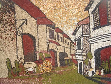
igan is an island, which used to be detached from the mainland by three rivers - the great Abra River, the Mestizo River and the Govantes River. It is unique among the Philippine towns because it is the country’s most extensive and only surviving historic city that dates back to the 15th century Spanish colonial period.

Vigan was an important coastal trading post in pre-colonial times. Long before the Spanish galleons, Chinese junks sailing from the South China Sea came to Isla de Bigan through the Mestizo River that surrounded the island. On board were sea-faring merchants that came to barter exotic goods from Asian kingdoms in exchange for gold, beeswax and other mountain products brought down by natives from the Cordilleras. Immigrants, mostly Chinese, settled in Vigan, intermarried with the natives and started the multi-cultural bloodline of the Bigueños.

In the book, The Philippine Island, Vol. III, p. 276, Blair and Robertson, two letters of Governor General Guido de Lavezares to King Philip II of Spain mentions: “It seemed best to send Captain Juan de Salcedo with 70 or 80 soldiers to people the coast of Los Ilocano on the shores of the river called Bigan.” Salcedo then sailed from Manila on May 20, 1572 and arrived in Vigan on June 12, 1572.

Thus, after the successful expedition and exploration of the North, Don Juan de Salcedo founded “Villa Fernandina de Vigan” in honor of King Philip II’s son, Prince Ferdinand who died at the tender age of four. From Vigan, Salcedo rounded the tip of Luzon and proceeded to pacify Camarines, Albay, and Catanduanes.

As a reward for his services to the King, Salcedo was awarded the old province of Ylocos which then composed of the Ilocos Norte, Ilocos Sur, Abra, La Union and some part of Mountain Province as his Encomienda and was accorded the title as Justicia Mayor de esta Provincia de Ylocos.

In January 1574, Salcedo returned to the capital of his Encomienda, Vigan, bringing with him some Augustinian Missionaries to pioneer the evangelization of Ylocos and established a Spanish city, for the purpose of controlling the neighboring country.

Governor General Gomez Perez Dasmarinas, in his Account of Encomienda dated in Manila on May 31, 1591 states: “The town of Vigan called Villa Fernandina has five or six Spanish citizens with one priest, a Justice, one Alcalde Mayor (Governor) and a Deputy. The King collects 800 tributes (equivalent to 3,200 subjects). During this period, the old Vigan was composed of 19 barrios.

In 1645-1660, Vigan was already divided into 21 Cavezas de Barangay as mentioned in the “Libro de Casamiento”, the oldest records of the parish house of Vigan found in its Archives. Separated from the naturales, the Chinese have their own place of settlement called pariancillo, “Los Sangleyes del parian” and the Spaniards were residents in a villa called “Los Españoles de la Villa”.

How Vigan got its name is told from an anecdote carried by the tongue of generations, which tells of a Spaniard walking along the banks of the Mestizo River. There, he met a native of the place and stopped to inquire: “Como se Ilama usted de esta lugar?”

Not understanding a word of Spanish, the native scratched his head and upon seeing that the Spaniard was pointing to a plant, exclaimed in Ilocano: “Bigaa Apo”. Bigaa being Alcasia Macroniza, a giant Taro plant belonging to the Gabi family which used to thrive at the bank of the Mestizo River. From the name of the plant – Bigaa, whence Vigan derived its name.

ERECTION OF THE DIOCESE OF NUEVA SEGOVIA AND THE CIUDAD FERNANDINA DE VIGAN

The Episcopal See of Manila was erected by Pope Gregory XVIII with the publication of his Bull Fulti Praesidio on December 21, 1581. It was elevated into a Metropolitan Church on August 14, 1595 through the Bull of erection of Pope Clement VIII with the Diocese of Santisimo Nombre de Jesus in Cebu, the Diocese of Nueva Caceres in Naga and the Diocese of Nueva Segovia in Lallo, Cagayan as its suffrage.

The Bull of Pope Clement VIII likewise elevated the seat of the four diocese including Lallo, Cagayan to the dignity of a city being the center of evangelization in their respective territories.

For 160 years from 1595 to 1758, all the Bishops of the Diocese of Nueva Segovia in Lallo Cagayan, starting with Fray Miguel Benavidez to Fray Diego de Soria preferred to stay in Vigan due to the deteriorating condition of Lallo at that time. Malaria was endemic to the place and was constantly flooded during the rainy season. The Rio Grande de Cagayan was eroding and destroying the site of the Diocese leading to a progressive decay of the town.

In sharp contrast, Vigan, during the same period, was a flourishing Spanish settlement nearer to Manila. It was fast developing into the center of Spanish influence and politico-economic power in the north.

When Don Juan dela Fuentes de Yepes became Bishop of Nueva Segovia in 1755, he requested the King Spain and the Pope for the transfer of the Diocese from Lallo, Cagayan to Vigan, which was at the height of its progress as center of religious, commercial and socio-cultural activities.

He summoned three former Alcalde Mayores: Don Maximino Ballero of Vigan, Don Juan Antonio Panelo of Pangasinan, and Don Francisco Ledem of Cagayan to testify and give their support of the requested transfer of the Diocese. Aside from the former Alcalde Mayores, Bishop Yepes also solicited the favorable endorsement of Fray Bernardo Ustaris of the Dominican Order and Fray Manuel Carillo of the Augustinians.

The transfer of the Seat of the Diocese of Nueva Segovia from Lallo, Cagayan to Vigan was formally approved during the Pontificate of Pope Benedict XIV during the reign of Fernando VI, King of Spain by virtue of the Royal Decree of September 7, 1758.

By this Royal Decree, Villa Fernandina which became the new seat of the Diocese automatically elevated its status as a City known as Ciudad Fernandina de Vigan in honor of the then current King of Spain.

By 1764, there were already 21 sitios or barrios in Vigan as mentioned by Father Pedro de Vivar in the document entitled as “Relacion de los Alzamientos dela Ciudad de Vigan, cavesera dela provincia de Ilocos Sur el los años 1762 y 1763.”

In 1803, Ciudad Fernandina de Vigan has a population of 10,585 souls with 1,966 paying tributes. The natives were working on agricultural land and the mestizos engaged in business with other provinces including Manila. The mestizos played a very important role in the progress and prosperity of the city of Vigan.

The Chinese in Vigan on the other hand, settled in a place called “Pariancillo” while in Manila they were in “Parian”. With their talent and knowledge in business as well as their skills and mastery of the art of manufacturing, the Chinese became rich and powerful in society. They opened business in the heart of Vigan, employed the naturales, intermarried with the natives and mestizos of Vigan and as time passed by; they rose into the class of the elite. They triggered a business boom in the community and engaged in domestic and foreign trade. They exported indigo, lime, maguey, basi, jars, tobacco, woven cloth called abel, and other local products to Europe, China, Borneo and Malaysia. As a consequence of this business boom, there was a mark change in the lifestyle of the inhabitants.

Found in the Philippine Archives in Manila is a report in 1870 describing Vigan, the place. West of the cathedral are the Casa Real and the monument of Salcedo, north of the cathedral is a small house, and south of the cathedral is the Seminary. West of the Seminary were the hacienda publica, barracks of the Carabineros and the Ayuntamiento Municipal.

To further justify the to category of Vigan as a city are the documents from “Instituto de Historia Programa de Modernization del Archivo Nacional de Filipinas” that describes that Vigan has its own carcel, casa de gobierno, mercado publico, Provincial High Court and one the only four (4) Public Works District in the entire Island of Luzon. More importantly, it has an Audencia Territorial, an implicit indication that it was a City.

Revolts and Social Unrest

Being the nucleus of religious, economic, political, social, commercial and cultural activities in the north for more than three centuries, Vigan became a hotbed of social unrest. The social inequity of caciquism and landlordism, the imposition of unfair tributes and other taxes on the natives, the abuses of foreign friars and civil administrators, the demand for free labor in the construction of civil and religious infrastructure, monopolies in some local industries, and the continued infringement on the rights of the citizens provoked the natives to revolt against established authorities.

In 1762, Diego Silang, the first Filipino emancipator led the famous Ilocano Revolt against the collection of exorbitant tributes and the imposition of monopoly on provincial commerce by the Alcalde Mayor and the “babaknangs” of Vigan. The revolt coincided with the short-lived British occupation of Manila. After Diego Silang was assassinated on May 28, 1763, his wife, Gabriela Silang, took over as leader of the uprising until she was captured and hanged publicly in Vigan four months later. She was later extolled as the Filipino Joan of Arc and the first woman to lead a revolt in the Islands.

In 1817, the civil government imposed a monopoly forbidding the Ilocanos to brew “basi” the sugarcane wine compelling them to buy the product from government controlled stores. On September of that year, Ambaristo led a popular uprising until they were caught and summarily executed along the banks of the Bantaoay River in the neighboring town of San Vicente, Ilocos Sur.

To warn the restless natives against any future attempts to overthrow the colonial government, a series of paintings was commissioned. In 1821, fourteen oil paintings measuring 91.44 by 91.44 centimeters each were produced by a Vigan-born painter named Esteban Pichay Villanueva (1797-1878).

Retelling the Basi Revolt from the Spanish colonial viewpoint, the fourteen paintings echo the via cruces or way of the cross paintings in churches. According to art historian Santiago Pilar, the paintings, in sequence show the following scenes: (1) Alcalde Mayor Juan Ybanez and local troops at vigil; (2) Ybanez calls the chiefs of Bantay, San Vicente, and Santa Catalina; (3) Chiefs of Candon and Santiago are reprimanded for tardiness; (4) Rebels of Ilocos Norte march to Ilocos Sur; (5) Troops sent to confront the revels; (6) An arrested rebel dies of lashing; (7) Vigan troops are sent to repel the enemies; (8) Natives flee to Bantay Church; (9) Bloody battle is wage at Bantaoay; (10) Dead rebels are buried; (11) Victory comes on September 7, 1807; (12) Convicts are brought to the gallows; (13) Revel leaders are hanged; (14) The condemned are decapitated.

Villanueva’s style is naïve. The figures appear two-dimensional, and follow the hierarchical perspective (the government officials are larger than the farmers on the same plane). According to Pilar, Villanueva did not take formal lessons in an established artistic tradition. He derived artistic devices in his environment. He stylized clouds in the manner of carved santo images.

The Basi Revolt paintings are important, not only because they chronicle, albeit rather prejudicially, a milestone in the Filipino struggle for freedom. The fourteen panels are important also because they are some of the finest examples of a particular stage in the development of paintings in the Philippines. Before the time of Villanueva, subjects for paintings were predominantly religious in nature. It was only in the 19th century that non-religious subjects became popular.

Today, the Basi Revolt paintings are on display at the Vigan branch of the National Museum, inside the ancestral house of Father Jose Burgos.

The Edict of Governor General Narciso Claveria in 1847 required all inhabitants of the Philippines to adopt surnames to facilitate the collection of taxes. Being the capital town, the “naturales” or natives in Vigan were required to adopt surnames beginning with the letter “A” while the mestizos with the letter “F”. In the case of the De Leon, Dela Cruz, Prudencio, Donato and Del Rosario families, each added another surname beginning with the letter “F”. Thus, Faz de Leon, Filar dela Cruz, but later dropping the dela Cruz and added the “T” to Filart, Foz Prudencio, Ferre Donato, and Fino del Rosario. It was also during this period that the influential Mariano family changed their surname to Formoso.

As early as in 1890, the prominent families of Vigan were quick to support the revolutionary movement of Gen. Emilio Aguinaldo against the Spaniards. Aguinaldo finally captured Vigan in 1896 making the Archbishop’s palace as the province’s revolutionary headquarters during the first phase of the Philippine revolution. General Tinio arrived in Vigan in 1898 to drive away all Spaniards out of Ilocos. Finally, on August 13, 1898, the Filipino flag was raised on top of the Archbishop’s palace for the first time in 325 years. Vigan and the rest of the Ilocos region were left completely in Filipino hands.

But on the same year, the Dewey squadron sank the entire Spanish fleet in Manila Bay. The Spanish-American War ended with the signing of the Treaty of Paris, which ceded the Philippines to the victorious Americans. This precipitated the Philippine-American War, which was announced in Vigan with the ringing of the bells. The Ilocos under the leadership of Gen. Tinio, the brothers Blas and Juan Villamor, and Bishop Gregorio Aglipay became the last bastion of defense against the incoming American forces until the US 45th Infantry under Col. James Parker captured Vigan in December 4, 1899.

In the fight against the Americans, the Katipunan movement was very much alive in Vigan. According to William Henry Scott – Ilocano Responses to American Aggression, 1900-1901, “ The Calvo family was associated with the family of Estanislao delos Reyes in a supply network which served Filipino forces from his mother’s house for more than a year before it was discovered and broken-up. Five feisty females operated it: Eleuteria Florentino, Salome Reyes, Lucia del Rosario, Conching Calvo and Carmen delos Reyes. They were arrested for “communicating with and giving aid and comfort to the insurgents and shipped to Fort Santiago in Manila on 18 February 1901. Eleuteria was Estanislao’s widowed mother whom “Dangadang” (Struggle) called “Capitana Teriang”. At the time of her death 30 years later, she was compared to Balintawak’s Tandang Sora. This family alliance, whose members occupy so much space in Vigan’s list of “names of natives connected with the insurgent government”, was based on the marriage of two Reyes brothers with two Florentino sisters and illustrates the sort of family solidarity which supported men in the field”.

The revolutionist finally surrendered to the Americans on February 1901. The Americans established a civil government in September 1, 1901, with Mena Crisologo as the first provincial governor. Ironically, Mena Crisologo was the husband of Felipa Florentino, Eleuteria’s elder sister.

MIRACLE DURING THE LIBERATION PERIOD

A miracle actually saved the town of Vigan during the last days of the Japanese occupation. As part of their military strategy at the end of the war, the Japanese were ordered to burn and completely destroy occupied zones before withdrawal. On the eve of their departure from Vigan, the Japanese Military Commander, Captain Fujiro Takahashi pleaded with the SVD procurator of the Vigan Seminary, Fr. Joseph Kleikamp, to take custody of the Japanese officer’s Filipino wife and their love child. The priest agreed on the condition that Takahashi and his men would leave Vigan without burning the town to prevent the town folks from seeking revenge on his family. (At that time, drums of gasoline was already strategically stored at the town plaza, ready to be used in burning the town). Takahashi agreed and left with his troops during the night.

The following morning, the people of Vigan discovered that the Japanese had left peacefully. They immediately spread an oversized American flag at the plaza forestalling the planned bombing by the Americans to flush out the Japanese forces. Thus, Vigan miraculously escaped total destruction, a misfortune that befell other colonial cities like Cebu and Intramuros in Manila.

POST WAR PERIOD

The Philippines was fully liberated from the Japanese on July 1, 1946. The Japanese lost in all, 409,267 killed and only 9,744 were taken as prisoners. American losses were 11,921 killed, 401 missing and 42,569 wounded or a total of 54,891. The ratio was 8 to 1. Over a million Filipinos, military and civilians were killed and the overall property damage in the Philippines was 16 billion pesos.

When the Japanese left Vigan on January 9, 1945, Dr. Gregorio Favis, the Japanese appointed mayor, went in hiding for fear of being caught by the guerillas. Late in March of 1947, Dr. Favis and Remedios Donato, his chief of police, were captured in Narvacan by the guerillas. They were tortured and executed at the outpost of the USAFE-NL “M” company near the junction of the national highway in Narvacan leading to Abra.

President Roxas succumbed to a heart attack while delivering a speech at Clark Field on April 16, 1948 and his Vice President, Elpidio Quirino assumed office as the 2nd President of the Republic. President Quirino was born in the building, which now houses the Provincial Jail in Vigan because his father was the prison warden then. He became the first Ilocano President and will long be remembered as the architect of the country’s foreign policy and for implementing the total economic mobilization program to rehabilitate a ravaged country just after the war. Because of his negative stand in the retention of the American bases in the Philippines, the CIA mounted a vicious propaganda campaign against him to prevent his re-election so that he could not continue as President in 1954 when the review of the bases agreement was to be resumed. He lost the Presidency to Ramon Magsaysay, his Secretary of National Defense, in the national elections of 1953.

The hand of fate wrote an unforgettable line in the history of Vigan when Congressman. Floro Crisologo was assassinated inside the St. Paul Cathedral on October 18, 1970 during the 4:00 PM mass. Following the death of the family Patriarch, the political leadership of the Crisologos ended on November 8, 1971 with the election of the charismatic Singson brothers – Luis as governor of Ilocos Sur and the elder Evaristo as Mayor of Vigan.

Towards the new millennium

At present, under the leadership of its first lady Mayor Eva Marie S. Medina, Vigan was inscribed in the UNESCO World Heritage List of Sites and Monuments last December 2, 1999 which now includes 630 cultural and natural properties of exceptional universal value in entire the world and one of the only five heritage sites found in the Philippines. With its inclusion in said prestigious list of world heritage sites, Vigan has become a source of pride, and a national symbol of the Filipinos.

As a sign of its continuing economic boom in the new millennium, Vigan became the first component city of the province of Ilocos Sur known as the City of Vigan through an overwhelming “Yes” votes cast by the Bigueños during the plebiscite last January 22, 2001. Indeed, once a city is always a city.

ROAD TO CITYHOOD

December 14, 1998 - Resolution No. 28, Series of 1998 was approved by the Sangguniang Bayan of Vigan and consequently approved by Mayor Eva Marie S. Medina requesting Congressman Salacnib Baterina to file in Congress a bill restoring the cityhood of Vigan based on its historical, cultural and architectural significance.

February 13, 1999 - H.B. 7122 entitled “ An Act Converting the Municipality of Vigan into a Component City of the Province of Ilocos Sur which shall be known as the City of Vigan” was filled in the House of Representatives sponsored by Congressman Salacnib Baterina and House Majority Floor Leader Mar Roxas.

April 27, 1999 - The Sangguniang Panlalawigan of the Province of Ilocos Sur approved SP Resolution No. 142, Series of 1999 entitled “A Resolution Approving Resolution No. 28, S. 1998 of the Sangguniang Bayan of Vigan, Ilocos Sur requesting the Hon. Congressman Salacnib Baterina to File a Bill in Congress Restoring the Cityhood Status of Vigan, Ilocos Sur, and Indorsing Favorable Congressional Attention Thereon”.

November 29, 1999 – The Public Hearing on H.B. 7122 was conducted by the Committee on Local Government of the House of Representatives headed by Rep. Romeo Candazo at the Vigan Youth Center. H.B. 7122 was approved in principle for the Second Reading because of the overwhelming support of the Bigueños.

December 6, 1999 – The Committee on Local Government approved H.B. 7122 for the Second Reading.

December 16, 1999 – The House of Representatives approved H.B. 8883 formerly known as H.B. 7122 for the Third Reading.

March 20, 2000 – The Committee on Local Government chaired by Sen. Aquilino Pimentel conducted a public hearing on Senate Bill 1801 “An Act Converting the Municipality of Vigan into a Component City of the Province of Ilocos Sur to be known as the City of Vigan” introduced by Sen. Serge Osmeña III.

October 4, 2000 - The Senate approved on Second Reading SB 2174, the substitute bill of SB 1801, entitled “An Act Validating and Recognizing the Creation of the City of Vigan by the Royal Decree of September 7, 1757 issued by Fernando VI, King of Spain” sponsored by Sen. Aquilino Pimentel, Jr. and Sen. Serge Osmeña III.

October 9, 2000 – S.B. 2174 otherwise known as “ An Act Validating and Recognizing the Creation of City of Vigan by Royal Decree of September 7, 1757 issued by Fernando VI, King of Spain was approved in the Senate for the Third Reading.

December 8, 2000 – Officially forwarded to the Presidential Legislative Liaison Office (PLLO) the consolidated H.B. 8883 and S.B. 2174 for the President’s signature. This was the start of the 30-day-rule for the President to act or not to act on it otherwise it is deemed approved.

December 27, 2000 - Signed into law Republic Act No. 8988 otherwise known as “An Act Validating and Recognizing the Creation of the City of Vigan by the Royal Decree of September 7, 1757 issued by Fernando VI, King of Spain”.

January 22, 2001 – The first Plebiscite ever to happen in Ilocos Sur regarding the conversion of a municipality into a component city was held in Vigan. Conducted and supervised by the Commission on Election, the question was: “Do you approve the validating and recognizing the creation of the City of Vigan by the Royal Degree of September 7, 1757 issued by Fernando VI, King of Spain, hereafter to be known as the City of Vigan, pursuant to R.A. No. 8988?” The people of Vigan unanimously ratified the creation of the City of Vigan where in 93% of the votes cast is YES and only 7% is No. Above all, the City of Vigan made a history of having the greatest number of electorates who participated in a Plebiscite up to this date. On this date on, Vigan is now the City of Vigan, the 1st City of the Province of Ilocos Sur.

Tuesday, July 29, 2008

What visitors say about Vigan

Conserving the Vigan lifestyle
By Augusto F. Villalon

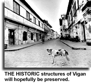
A RECENT visit to Vigan with a foreign colleague on a mission to assess the efforts to conserve the town by the municipal officials and local residents since 1987 turned out to be much more than just doing a survey.

We realized that the charm of Vigan began to take hold the instant we checked into Gordion Inn, a delightful bed-and-breakfast inn tucked under the high ceilings of vast ground floor in a stately century-old home. Its brick café overlooking a luxuriant garden patio offered the perfect vignette of the 19th-century scenes that Vigan is all about. What better introduction could there be to the quality of life in this fascinating town?

After walking the entire historic center of Vigan for a firsthand look at the town, and after a round of meetings with town officials, the clergy, businessmen and private homeowners, the extent of the conservation activities were apparent.

What became more apparent was that the conservation of Vigan was beyond just taking care of the old structures but that the life that continues to go on within those structures must be kept. After all, what good are well-conserved heritage structures that stand empty without any life in them?

First effort

The first effort to conserve the historic structures of Vigan started in 1987 when the National Museum assisted a group of concerned residents to produce an inventory of heritage houses. It listed close to 190 houses.

In 1996, another survey done by the Save Vigan Ancestral Homes Association (SVAHAI), by a grant from the Toyota Foundation, listed approximately 120 homes.

However, it does not take an inventory to see that a good number of the heritage homes in the town have disappeared and are endangered. Walking in the town gives enough evidence of the destruction.

Now that destruction is being controlled. More people have become aware of the need and have become involved in conservation today than the handful crying out in 1987. Now conservation is one of the primary topics.

What makes the Vigan conservation movement noteworthy is that it has always been spearheaded by NGOs, but always with strong municipal government support that continues to grow with so much enthusiasm and vigor.

Reinforcing the NGO conservation programs, the Sangguniang Bayan of Vigan responded by enacting municipal ordinances specifying the historic center boundaries of the town where structures must be strictly conserved. Another ordinance reaffirms that all conservation must be done in accordance with technically accepted principles. In support of the latter, Unesco and SVAHAI have written and will soon publish a handbook that outlines the conservation procedures to be used.

Public awareness and government mechanisms are clearly falling into place in Vigan to protect its heritage, even if some perceive it as happening too slowly.

More important, to signify the commitment of the municipal government of Vigan to conservation, the town submitted a dossier in 1998 that nominates their town for the Unesco World Heritage Listing. Inscription in the prestigious listing will at last accord Vigan the well-deserved status of being one of the most historically significant urban areas in the globe.

Vigan is definitely in the same league of uniqueness and high artistic character as Lijang in China, San Gimigniano in Italy, and Potosi in Mexico.

Special allure

The special allure of the town, as all Filipinos know, is that Vigan is where the country's largest collection of Hispanic-era architecture still stands along straight, narrow streets. What many Filipinos don't know is that Vigan has an equally significant (but smaller) collection of early 20th-century American-period architecture as well.

There are the usual tourist amenities: restaurants, antique shops and souvenir shops. A calesa ride takes you to the magnificent cathedral, truly worth a visit, and if you are fortunate to find it open, catch the dazzling collection of church treasures at Archbishop's Museum next door.

At the far end of the plaza, behind the gracious Palladian 20th-century Ilocos Sur Provincial Capitol, the Burgos Museum is practically the only opportunity for the visitor to enter a typical Vigan house.

Although every effort has been made to keep its interiors like a turn-of-the-century house, it is still laid out as a museum with excellent exhibits and didactic material. It is more institutional than residential.

While agreeing with scholars who have said Vigan is nothing without its houses, Vigan is more than an urban area with a magnificent collection of 19th-century architecture. Vigan is its people and the life they have always lived in the town and inside the structures that were their homes.

Over the centuries, the historic, cultural and geographic forces that shaped Vigan developed a special lifestyle that is unique in the Ilocos region and in the entire country. That lifestyle should continue into the next century. It provides the human touch that continues the flow of the energy of the ages into the heritage buildings.

Vigan is really more than the shattered homes that visitors pass through as they walk the historic center of the town. Those are only the envelopes that contain Vigan life, and the few houses that today still shelter Vigan life are inaccessible to the ordinary visitor.

The experience of Vigan changes as soon as the visitor enters one of the private homes, sees how the contemporary Viganense live with a mix of heirloom furniture, computer tables with ergonomic chairs, gas stoves, 1999 calendars hung on the walls together with faded sepia portraits of ancestors, all under the light of 80-year-old chandeliers.

What eludes tourists

Experiencing the heritage of Vigan is experiencing the poetry of Leona Florentino, seeing the magnificent Basi Revolt paintings at the Burgos Museum, seeing the residences and birthplaces of Philippine Presidents (Quirino) and eminent statesmen (Singson-Encarnacion, Mena Crisologo).

Tasting the heritage of Vigan is feasting on longganisa, lomo, pansit musiko, pipian, ipon and the unbeatable freshness of its pakbets and vegetable dishes that go with the cholesterol-deadly bagnet and the ever-present trio of tomatoes, onions and bagoong (kamatis, bagoong, lasuna or KBL). The taste of Vigan is practically unavailable in the town restaurants that prefer to serve generic Filipino food rather than the special Vigan cuisine.

What the survey mission found out was that it is the special Vigan lifestyle that gives substance to the town. It is the culture of Vigan, the energy that connects Vigan to its past and links it to its future.

With equal commitment that the inventory and conservation measures are being done for its historic structures, conservation of the Vigan lifestyle must be done.

Visiting Vigan is indeed taking a step backward. It is visiting our roots. It is indeed where history returns to life, but it is where the texture of Vigan life eludes the tourist.

Monday, July 28, 2008

Architects and Heritage Conservation


Vigan City Vice Mayor Franz
I
personally challenged the Architects of Ilocos Sur to uphold the Accessibility Law, the Vigan Conservation Code, and to engage in Conservation Architecture since most of them are practicing in the Heritage City of Vigan.
READ ON...

The Buridek Museum, the Third Children's Museum in the Philippines

These are the people behind the third Children's Museum in the Philippines, the Buridek Museum located at Mira Hills, Barangay Pagburnayan, Vigan City. (The author went to the next seminar room, thus was not included in the photo.

The Buridek Museum is another milestone achievement of the Medina Administration on Heritage Conservation. Headed by Prof. Eric B. Zerrudo of the UST Center for Cultural Preservation.

Eric Zerrudo

Professor Eric Babar Zerrudo, expert on cultural heritage and museum development. Vigan city's consultant on Heritage Conservation

... from the speech of introduction by Vigan City Mayor Eva Marie S. Medina
  • Raised and schooled to excel from grade school of Centro Escolar University as Valedictorian,
  • San Beda College High School as Salutatorian,
  • a Baccalaureate of the Arts in Economics Magna cum Laude at De La Salle University,
  • with a candidacy of Master in Arts at the University of the Philippines,
  • Obtained in 2001 a Master of Cultural Heritage with high distinction from Deakin University in Australia;
  • visiting researcher as well as language grants in Japan and Germany;
  • cultural grants to Korea, China, Australia, Japan and the United Staes of America;
  • the cultural missions he undertook; conferences, seminars, workshops he attended; various international visits, books and papers he authored are too numerous to mention.
  • Suffice it to say that all of these activities, together with the various professional positions he held such as
  • Director for Administration of the Metropolitan Museum of Manila,
  • Vice President of the GSIS Physical resource Office Administration Group and
  • Director for Administration of the UST Center for the Conservation of Cultural Property and the Environment in the Tropics,
  • has honed his skills in cultural heritage, museum development, property management and corporate affairs, that we have been fortunate to have him as
  • hands-on consultant and trainer in our cultural mapping project.

A Letter to Japan (My reply to Ms. Ha)

Excerpt from the letter of Ms. Ha of Waseda University, Tokyo, Japan.

...what Vigan is most concerned about are: 1/ ancestral houses have become too much business-like modified that some of them have lost their authentic look; 2/ more rich businessmen from outside (mostly from Manila) are coming to invest in Vigan that local people somehow have to move out or lose many benefits to those people; and 3/ the growing gap between the rich and poor in the city.

My Reply:

1/ ancestral houses have become too much business-like modified that some of them have lost their authentic look;
--First of all, let me tell you that the present state of the ancestral houses are the results of the conservation efforts of the city government to restore the once glorious Spanish city in the Philippines, Ciudad La Fernandina. Before the conservation of the Medina Administration (couples Eva Marie Singson Medina and Ferdinand Cruz Medina), the old Spanish Ancestral houses have been dilapidated and unkempt. They ahve been abandoned by their owners and left to caretakers. What you see now along the kilometer length of Calle Crisologo is the original street formerly known as the Kasanglayan District or "Chinese" District where once the enterprising Chinese traders lived and established their families. It was the Chinatown of the North during its time. So that whatever commercialism there is today is not "new." It has always been a commercial district. In fact, it was called "Escolta" the same trading center place in Manila wherem yes, Chinese abound.
--The new commercial establishments seen in the city right now are newly erected buildings constructed based on the design of the ancestral houses, a pre-requisite design for buildings that are to be built within the designated core zone of the city. Some of such establishments are the Jolibee, McDonalds and the new Two Brothers Grocery. The city government is very much in control of the constructions taking place in the core zones so as to preserve the original structures. Some restoratuve works were done, cleaning so to speak as these houses have been rented out as warehouses by their owners when they left for abroad.

2/ more rich businessmen from outside (mostly from Manila) are coming to invest in Vigan that local people somehow have to move out or lose many benefits to those people;

While it may be true that "rich" businessmen have come to invest in Vigan, the local people did not have to "move out or lost many benefits..." The investment climate prevailing in Vigan is in tune with the urbanization that is taking place in this young city. The existence of modern amenities have not dislodged local people but have in fact added more clientele as more people from neighboring towns and provinces come to Vigan, adding to the number of spenders in the area, benefitting everyone doing business.

3/ the growing gap between the rich and poor in the city.

Statistics show that this is not true. Vigan City continues to show as having the lowest incidence of poverty in the Region. And it will always remain as such, considering the many Poverty-Alleviation programs being embarked by the city governemnt through its livelihood projects, skills enhancement meant to empower the people earn a living, both locally and internationally.

In my next posts, I will tackle the many Anti-Poverty Projects of the City. Hang on..

The Vigan Master Plan

In 1990, the people and the municipal government of Vigan came u with Ordinance No. 5 setting the boundaries of the protected zone within the historic core and providing clauses for the protection of the historic buildings similar to those of national laws enacted in the 1970s. Ordinance Nos. 12 and 14 were also enacted in 1997 defining the core and buffer zones of the historic town, and providing the guidelines for its conservation respectively. Ordinance No. 5, series of 1999 also redefined the boundaries of the core and buffer zones. Recently, the municipal government also came out with Ordinance No. 4, series of 2000, enacting the preservation and conservation guidelines for Vigan ancestral houses.

With its cultural and historical significance, Vigan was recognized as a major tourism priority for development by the World Tourism Organization/UNDP Philippine Tourism Master Plan, European Community Technical Assistance Project for the Tourism Sector, Northwestern Luzon Growth Quadrangle Master Plan, and Tourism Master Development Plan for Region I. Vigan was also nominated three times for the UNESCO World Heritage List and was finally included in on December 2, 1999.

In 1996, the Philippine Government requested the Government of Spain to provide technical assistance in identifying specific projects for the revitalization of this historic center not only as a tourist attraction but most importantly as a national treasure of the Hispanic legacy to the Philippines.

The Memorandum of Agreement for the Formulation of a Master Development Plan for the Revitalization of the Historic Center of Vigan was finally signed on March 23, 1999.
The Vigan Master Plan Project, as it is now popularly known, started in April 1999 and was completed in April 2001.

The Vigan Master Plan Project was meant to foster development by promoting the preservation and conservation of the Filipino historical and cultural heritage and resources for the appreciation of its history and culture; developing tourism along the lines of conserving the socio-cultural heritage, preserving the environment and sustaining development; and contributing to the enhancement of the quality of life of all the inhabitants of Vigan.

Strategically, the Master Plan was formulated to revitalize of the historic town of Vigan; enhance knowledge in crafts/skills which are relevant to revitalization and ecologically sustainable livelihood; come up with a concept on packaging and promoting the Vigan Heritage Village with other tourism destinations within the province and Region I in order to ensure its position in the region’s tourism market; and formulate viable investment strategies for pursuing development in the study area.

The Master Plan has 10 Project Components, namely, Physical Development Planning, Socio-Cultural Aspect, Socio-Economic Aspect, Ecology and Environmental Aspect, Legal Aspect, Financial Aspect, Project Development, Institutional Aspect, Collaboration between the University of Northern Philippines (UNP) and the Master Plan, and the Vigan Culture and Trade Center.

As a Physical Development Planning tool, the VMP can be used to assess the town’s situation as regards to individual buildings, structures, open spaces, land use, traffic, etc., and to present recommendations on such as well as on infrastructure and services.

On the socio-cultural aspect, the VMP can be used to identify the various stakeholders and special interest groups, and elicit their comments on and recommendations for development projects which are congruent with the conservation of culture and environment.
As a socio-economic tool, the VMP can be used to conduct an inventory of the existing livelihood activities, crafts, cottage industries, talents/skills and cooperatives, and recommend short, medium and long-term projects that will promote and enhance such.

The VMP also has the capacity to assess the health and sanitation situation as well as the carrying capacity of the historic center, and recommend appropriate policy reforms and legislation ecology and environmental aspect the VMP can. The Legal Aspect of the Plan can make an inventory of the existing laws, government rules, regulations and ordinances on restoration and conservation, and draft legislation in furtherance of such policies for the consideration of the government’s legislative branch. On the Financial Aspect a financing scheme can be developed for the rehabilitation program that is focused on fund-sourcing, payback, cost recovery and guarantee mechanisms. As a tool for Project Development, it can be used to prepare proposals for viable and sustainable livelihood projects, and identify and prioritize structures/areas for possible and immediate rehabilitation.

Institutionally, the appropriate organization can be determined, including its functions and composition, that will regulate and monitor the implementation and continuity of the projects and programs established by the Master Plan, as well as to determine institutional mechanisms that will ensure the participation of all the stakeholders and thereby also ensure the sustainability and autonomous growth of the project areas. Another aspect is the Collaboration between the University of Northern Philippines (UNP) and the Master Plan. The Medina administration, recognizing the importance of the university as a center for excellence and critical thinking, tapped the UNP to assist in setting the master plan’s direction and provide human as well as material resources for the project. The last but significant aspect is the restoration of a public building which will be the training, trade and exhibition center for local culture, arts and crafts, and which will house the Municipal and Tourism Information Offices is now being undertaken, the Vigan Culture and Trade Center.

The main Agencies Involved in the Vigan Master Plan Project were the Municipal Government of Vigan,
the Provincial Government of Ilocos Sur, the Vigan Heritage Village Commission, the Department of Tourism, Fundación Santiago and the Agencia Española de Cooperación Internacional

The Vigan Community was tasked to be an active participant in the promotion of public awareness of the local and global significance of Vigan as a World Heritage Site; help ensure the historical and cultural value of Vigan by engaging in ecologically sustainable livelihood; enhance the vibrant community life of Vigan by building on the artistic and cultural traditions not only of Vigan but also of the Ilocos.

The formulation of the Master Plan was funded by the Government of Spain and the Government of the Philippines, with Fundacion Santiago as the project fund holder.

The Vigan Master Plan Office is at the 2nd Floor of the Leona Florentino House at # 1 Mena Crisologo St., Vigan, Ilocos Sur with Telefax: (63) (77) 722-1148.

Source: www.vigancity.gov.ph

Vigan City Council Resolution Adopting the Vigan Master Development Plan

Republic of the Philippines
Province of Ilocos Sur
CITY OF VIGAN
OFFICE OF THE SANGGUNIANG PANLUNGSOD
FIRST CITY COUNCIL
Resolution No. 16
Series of 2002
A RESOLUTION ADOPTING THE VIGAN MASTER DEVELOPMENT PLAN AS
BLUEPRINT FOR DEVELOPMENT.

WHEREAS, the City of Vigan possesses wealth potential that has not been fully developed;
WHEREAS, the Master Plan aims to create the paths leading to the development of this wealth;
WHEREAS, the Master Plan has been drawn up with the following objectives;

PLEASE READ ON


A Letter from Japan

Dear Ms. Jo Haygood,

Thank you very much for your e-mail! I’ve been always longing to hear from Vigan!

I’m half way on my research on Vigan’s heritage conservation. Last week, we had a discussion among the professors at Waseda University concerning the problems that Vigan is facing. One of them told me what Vigan is most concerned about are: 1/ ancestral houses have become too much business-like modified that some of them have lost their authentic look; 2/ more rich businessmen from outside (mostly from Manila) are coming to invest in Vigan that local people somehow have to move out or lose many benefits to those people; and 3/ the growing gap between the rich and poor in the city. I wonder if these things are true and there is nothing better than hearing it from a city planner like you! I’ve never been to Vigan (yet I hope I will soon), therefore, what I have seen or known about Vigan are merely from internet sources or other people’s stories. I wish I could truly understand the people from Vigan historic center, who and what they are, what they think about their heritage and what problems they have to face everyday.

I have checked out your website and really like it. I hope I can get more insights of Vigan from your future writing. If you don’t mind, I wonder if I can have some small discussions with you regarding Vigan cultural heritage in the next emails?

Thank you so much for time. I wish you all the best and look forwards to further discussion with you.

Kind regards,

Q.T.Ha

------------------------------------

Quach Thu Ha (Ms.)

Graduate School of Asia-Pacific Studies

Waseda University

Tokyo, JAPAN

Thursday, July 24, 2008

HISTORY OF VIGAN WESTERN BARANGAYS

THE BARANGAY OF PAOA

Paoa is bounded in the North by Ayusan Norte; on the East by Tamag; on the West by Ayusan Sur; and on the South by Tamag and by Bulala Hills.

During the olden days, a place which we call now, Paoa (after a Chinese named Paoa), was near a navigable tributary of the Abra River. This river had an outlet to the China Sea located between the Barangays of Mindoro in Vigan and Cabittaogan in Sta. Catalina (Barangay Pantay in Vigan did not exist yet at that time as this island barangay was only formed about a century ago, according to information). This outlet or delta was used by galleons as smaller ships as their entrance to a settlement now called Vigan. Some of the ships unloaded their cargos in place between the delta and Vigan, like Ayusan and Paoa, because the natives wanted to barter their products with the cargoes of the ships. One of the traders who often traded with the people in the above-named place was a Chinese named Paoa, a ship owner.

The Chinaman, after disposing off his cargoes and while preparing for his return to China in late May, was stranded in the place because his ship was destroyed by a typhoom which hit Northern Luzon at that time. As his ship was undergoing repairs, he had to live with the people for the time being. Besides, he had to dispose off his merchandise and for the favorable winds of the month of October for his return trip to China. Because of Paoa’s popularity and good-dealings with the people of the place, people of the adjacent village called the place Paoa.

THE BARANGAY OF AYUSAN

The two barangay of Ayusan Sur and Ayusan Norte are bounded on the north by the Barraca ti Ili (now solid west); on the east by Tamag, Paoa, and Pagburnayan; on the west by a tributary of the Abra River (more popularly called the Mindoro River); and on the south by Bulala. For the purpose of this study, the two Barangays are studied as one for the reason that there was only one barangay of Ayusan during the Spanish time.

The place was sparsely populated during the early part of the Spanish period. It was only a place were flood water found its way to a river flowing to the China Sea. Many houses that were washed away during typhoons and flood drifted to the river banks near Ayusan. It was for this reason that people of the other villages called the place “Ayusan” and Ilocano word which refers to a place where water flows.

The old barangay of Ayusan is at present divided into two; Ayusan Norte and Ayusan Sur are more economically progressive as it is the home of rice and corn traders. Ayusan Sur is the home of pot makers, market vendors and carpenters. Besides, it is the source of clay which is used in making earthen ware.

THE BARANGAY BULALA

Bulala is bounded on the north by the Mindoro river; east by Ayusan Sur, Paoa and Tamag; on the west by Mindoro and San Pedro and on the south by paratong and Barraca.

The barangay under study is situated along the National Highway going to Mindoro Airport. It is divided into three zones, namely Bulala Norte, Bulala Sur and Calumbuyan. These sitios, however are not independent from one another as they have only one barangay government and they are under the leadership of only one barangay captain.

The name of the barangay is derived from the name of trees that were growing abundantly aalong a river in the place a couple of centuries ago. The tree is called “bulala” which, is used in making floors of houses, will produce a kind of lumber that is golden yellow in color. One does not need floor wax to polish it as it becomes shiny easily by scrubbing it with a coconut husk and banana leaves. Because of the utility of “bulala” lumber, the “bulala” trees had been cut down so that at present there is only one of its kind that is standing near the road crossing at a place in the barangay called “pagdaanan”.

The people of Bulala are peace-loving, industrious and hospitable. The occupations of the people are pot making, fishing, farming and some are government employees.


BARANGAY OF SAN PEDRO

San Pedro is bounded on the north by Mindoro; on the east by Barraca, Paratong and Bulala; obn the west by the China Sea; and on the South by the China Sea and the Manangat River.

The barangay is divided into two sitios, san Pedro Norte and san Pedro Sur. The former is sometimes called “Nagtupakan” and the latter is called “Cruz”. One of the sitios was called “Nagtupakan” because the place was suddenly inhabited by the people from Sta. Catalina, Ilocos Sur. The other sitio was called “cruz” due to a wooden cross believed to have been planted by the Spanish colonizers in a place not very far from the sea.

The barangay as a whole is called San Pedro because the people being fisherman choose St. Peter (San Pedro) as their Patron Saint when the chapel was constructed in the place. It is to be recalled, in this connection, that Saint Peter was a fisherman, according to the Scriptures.

The barangay folks also are industrious and their second occupation is weaving. When men go out to fish in their motorized bancas, the women are at home weaving until the wee hours of the morning.


BARANGAY MINDORO

Mindoro is bounded in the North by the Mindoro River; on the East by Bulala; on the West by the China Sea; and on the South by San Pedro and the China Sea.

During the early part of the 18th century, the number od houses in the place could only counted by the fingers. Fishing was the main occupation of the inhabitants as the sea and the river near the barangay were rich in fish resources. Fish during those days did not, however, command good price because fish was abundant everywhere, so that the people were not of fishing only as their occupation. It was forth this reason that the people of the place wanted to find a secondary source of livelihood like what other people living along the seacoast at that time were doing and that was extracting gold from the sand. This was similar to what Californians were doing in the early part of the 19th century in the United States.

People from other villages inhabited the place due to the lucrative gold business, so that there was even a time when gold-producing sea-coast of Vigan was called “Pagsay-oan”, meaning a place where to get gold by means of splashing water against the strainer containing sand.

This activity of extracting sand or “minas de oro” during the Spanish times led to the coining of the word Mindoro which subsequently became the name of the place.

BARANGAY BARRACA

Barraca is bounded in the east by Pong-ol, on the south by Manangat River, on the west by San Pedro Sur and Mindoro Airport; and on the north by Sitio Calumbuyan of Barangay Bulala.

The place which we now call Barraca was a mooring place during the Spanish time near the airport of Vigan which was located in Pong-ol. The place was then shallow especially during low tides so that the ships that anchored there would sit on the sand like ducks and could not move. In the dialect, when the water craft sits on the sand bar, it is termed as “naibarra”. Many old residents of the place say that it is from the native word that the name of the village was derived. However, some of the men who were sea men during their prime years say that its name was taken from the word “baradero”, a mooring site of ships during the rainy season, hence the name Barraca.

Barraca is a small barangay when it comes to population because many of its inhabitants had settled to other regions for a greener pasture. The present principal occupations of the people are fishing and pot making.


THE BARANGAYS OF PANTAY


The barangays are bounded on the north by the Santa Catalina River, on the east by the dried portion of the Mindoro River and Solid West and on the west by the China Sea and on the south by the Mindoro River. The place is now divided into three Barangays: Pantay Daya, Pantay Fatima and Pantay Laud.

The above barangay was non-existent in the olden times. The existence of the island where they are located now began when a big branch of the Abra River between Vigan and Sta. Catalina had become less navigable. This resulted to a formation of a n island in the middle of the above-mentioned river. The island was small in the beginning but its area kept on increasing as the years went by. Few families inhabited the place at first, but settlers from Sta. Catalina were attracted later because of the fertility of the soil. Some of the first inhabitants were the Arca, Alias, Amigable and Arconado families.

The name Pantay was taken from the very fact that the word means an island that is formed by means of receding waters. The island was small at the beginning but it became bigger as the years passed by through natural process of soil formation.

Most of the inhabitants of Pantay at present are farmers and fishpond owners. Many are also professionals and businessmen.

HISTORY OF VIGAN EASTERN BARANGAYS

CAPANGPANGAN

The first eastern barangay from the poblacion is Capangpangan, which was so called because supposedly, the first settlers in the area originated from the province of Pampanga. These settlers were also leather craftsmen (agkurkurti ti lalat) who may somehow have also been into the pagpartian business. They gathered the skin of the slaughtered animals (e.g. cows, carabaos), dried and made these into knife holsters and beaded slippers.

Understandably, the first Capangpangan settlers chose the river banks area (eastern side of the northern tip of the Mestizo River) because their livelihood activity necessitated so. Washing of the animal skin could be done in the river and the banks could be used to dry them. Likewise, the riverbanks abounded with camachile trees which barks were used in curing the leather. Besides, this location was far enough to bother the city’s residential center with polluting smell associated with the craft.

Leather craft in Capangpangan lasted until the 1960’s. It eventually became extinct with the onslaught of cheaper factory-manufactured slippers. At present, many Capangpangan residents are into meat processing, like the residents of the neighboring Pagpartian.

The originally small settlement has also become one of the most congested and densely-populated non-poblacion barangays of Vigan.

BARANGAY NAGSANGALAN

Nagsangalan is bounded on the north by San Julian East, Bantay; on the east by Purok a Bassit; on the west by San Jose; and on the south by Bongtolan.

The barangay is situated in a piece of territory where one could find a big road crossing during the olden days. This was a place where bamboo grooves grew on both sides of the road so it earned the name “Kinawayanan”.

When the Spaniards had already implanted the catholic faith in Vigan about the end of the sixteenth century, some natives of the village were hired as “fiscales” to serve in the convent of the parish church in the poblacion. A fiscal was one who assisted the parish priest in his daily activities like ringing the bells, and making schedules for marriage, baptism, funerals and the like. It is for this reason that the barrio, at a certain period was called “Cafiscalan.”

West of the barrio road crossing were a number of families who were makers of white squash hats called “cat-tucong” in the dialect. The people of this place was gifted with artistic ability that people from other regions marveled at that craftsmanship displayed by the makers of the white squash hats. It was on this account that the place was named “Cacat-tucongan” at certain epoch of the history of the village.

Several names were given to the different sections of the village. As a whole it was called “Nagsangalan” or “Nagcorosan” in the dialect.


CABAROAN

Cabaroan is bounded on the north by Nagsangalan; on the east by Bongtolan; on the west by Cabalangegan; and on the south by camangaan. It is at present divided into two Barangays namely: Cabaroan Daya and Cabaroan Laud. But in as much as the origin of the name is the main purpose of this study, the two Barangays are studied as one.

As early as the founding of Vigan by Captain Juan de Salcedo, the village was inhabited by Tinggians (Itnegs) who were industrious and peace-loving people. They were farmers and they produced rootcrops like peanuts, camotes, singkamas, and togi in the dialect.

The place was sparely populated at the time so that the governadorcillo (mayor) of Vigan wanted develop the place by inviting people from densely populated areas to settle there. A family was given an area to cultivate so that the Itnegs were displaced by the new settlers. Many settled in the place in the later years and became prosperous. Roads and trails were built and village government was established. The place then became the newest and the youngest village of the Mestizo River at that time. And it came to be called “Cabaroan”, which means newest in English.

Almost oof the families have farmlands to cultivate where they planted rice, corn, root crops and vegetables. Aside from being farmers, the inhabitants are also weaver of Ilocano cloth.


BARANGAY RUGSUANAN


Rugsuanan is bounded on the north by Raois and Purok a Dackel; on the east by Raois; on the west by Purok a dackel; and on thesouth by Nagpanawan, Santa.

The name of the place can be traced as far back at the time when the Abra River was still very active, navigable and destructive. It was then the “Huang Ho” of Ilocandia where many lives were losts and properties destroyed when the river overflowed its banks. Santa, Vigan and Caoyan experienced the adverse effects of its annual floods, so that several hectares of lands were washed away by the river’s turbulent waters.

In the municipality of Caoayan, for example, a barrio by the name of Nalasin, was eroded so that its inhabitants had to move to safer grounds located near Barangay Raois in Vigan. This place in subsequent years was named “Nagtupacan” which in English means a place where a group of people settled simultaneously and suddenly.

The people of Nagtupacan were happy and contented, because in the first place, the people will not be bothered by the yearly floods anymore caused by the turbulent waters of the Abra River, and secondly, the people had found god sources of livelihood, like fishing, farming and weaving. Prosperity reigned in the barrio which adjacent villages envied, so that the inhabitants decided spent a special day for thanksgiving to the Almighty. This feeling of contentment and happiness (rugso in Iloco) was the basis of naming the barrio “Rugsanan” which all the people of the place acceded.

It is true that the barangay does not have large tracts of agricultural land to cultivate; but the people are compensated through their involvement in various occupational pursuits like weaving, fishing, retail business and small scale farming.


BARANGAY PONG-OL


Pong-ol is bounded on the north by Paratong, on the east by Salindeg, on the west by Barraca, on the south by the Manangat River,a branch of the Caoyan River.

The barangay was a busy sub-port of Vigan during the eighteenth and nineteenth centuries. It is to be called that a British frigate anchored at Pong-ol, and a representative of Governor dawsonne Drake landed and handed a letter to Diego Silang appointing him as governor of the Ilocos in 1762.

Information had it when a ship just arrived at the port, a man had to blow a horn just to make people know that laborers are needed to help in the unloading of the ship cargoes. The blowing of the horn had a connection to the meaning of the village.

One day, a squad of Spanish civil guards patrolled the place. They saw a man holding a horn and asked him about the name of the village. The man did not understand Spanish so he thought that the Spaniards were asking him to blow his horn; so he did it. As he was blowing his horn, the dogs barked. The patrol leader then decided that the sound (pong) caused by the blowing of the horn and the barking (ol-ol) of the dogs would be the basis in naming the village. The Spaniards then, named it Pong-ol.

Presently, the port had disappeared and the navigable river is already dry, thereby depriving the male inhabitants of their profitable occupation – ship navigation.


PUROK A BASSIT AND PUROK A DACKEL


The two Barangays are bounded on the north by san Isidro; on the west by a wide tract of land belonging to the Municipality of Bantay, on the east by Raois and on the south by a wide area of land, a portion of which belongs to the Municipality of Caoayan.

During the Spanish period, when the village of Purok was not still divided into two, the eastern section was more populous than the western part. Literact rate was high in the eastern section, so that this fact might have been the reason why heads of the barangay (cabezas de barangay) were chosen from that place. There was a time when the said section was called taga-Pajo, because one of the most popular cabezas de barangay, Don Cleto pajo, was a resident of that section of the village.

Time came when the population of the village became bigger and life became more progressive. They found time to relax by spending on merriment, besides thanking the Lord for their growing prosperity. But as the village, during those times, was far from the main municipal road, the inhabitants of the Pajo section decided to move to another section of the village which was more accessible to the municipal road, thus giving more facility to travel to and from the place. The section where Pajo folks established their residence came to be called Purok a Bassit, a village that was carved out from the mother village, Purok a Dakkel.


CABALANGEGAN


Cabalangegan is bounded on the north by San Julian Sur, on the east by Cabaroan laud; on the west by Mestizo River, and on the south by Beddeng laud.

The name, Cabalangegan, as some people claimed, was not derived from the name of a plant called “balangeg” in the dialect, which grows abundantly in fresh water, ponds or lakes. The name Cabalangegan came from the name of an underground root called “Camangeg”. How the name of the village originated, it came about this way:

During the Spanish regime, when the Spaniards already established their government in Ilocos, the inhabitants of the village now called Cabalangegan were industrious, peace-loving and courageous. They could be distinguished from the people of other villages because of a very special weapon they possessed which is called “palsuot”, in the dialect. The “palsuot”, bamboo gun, has a barrel of about one and a half feet long which has a bore of about one half inch in diameter. It is equipped with a bamboo rod which is inserted in the hole and it is used to push the bullet made from “camangeg” out the hole.

Camangeg grew abundantly on that place during the Spanish times and people of the surrounding village were unanimous in calling it “camangeg”. The name had been used for several decades. But time came when the people changed the name into “cabalangegan” to have facility in pronouncing it.


BONGTOLAN

Bongtolan is bounded on the north by Cabaroan Daya, on the east by Nansuagao, on the west by a large area of land, and on the south by Camangaan.

Like other villages of Vigan, Bongtolan has no official name not until the Spaniards had established theor governmental machinery in Ilocandia under the leadership of the “Hernando Cortez” of the Philippines, Captain Juan de Salcedo.

It was summer time when the Spanish civil guards busied themselves patrolling the suburbs of Salcedo’s captain town that they came upon a village which was quite opposed to Spanish conquest. The villagers were angered with the behavior of the Spanish civil guards because oftentimes, the guards get food like fowls, eggs, vegetables and fruits from them. In order to show their displeasure against the bad acts of the Civil Guards, the natives of the place agreed to do something that would irritate the foreign intruders. So, one day, some of the men of the place climbed the trees along the trails which led to the center of the village with dried earth balls (bingkol in Iloco) in their hands. They threw down the earth balls on the heads of the soldiers as they passed by, injuring some of the unhelmeted ones. Many were arrested and tortured so the arrogant acts of the natives were removed. Through the advice of the Ilocanos closed to the Spanish authorities in Vigan, the place was named “Uluan”, because the main target of the natives were the soldiers’ heads.


BARANGAY BEDDENG

Beddeng at present is divided into two barangays: Beddeng Daya and Beddeng Laud. Beddeng, as a whole is bounded on the north by Camangaan and a branch of the Mestiizo River, and on the south by Naguilian, Caoayan.

There was not much difficulty in naming the place for its name was derived from the word “beddeng” or border in English because it is a border barrio of Vigan and Caoayan, east of the Mestizo River. However, there was confusion as to what municipality the place should belong to because as per location, Beddeng is located south of the branch of the Mestizo River, and this river branch was believed to be the boundary between the Vigan and Caoayan. Based on information gathered, the early inhabitants decided that the village would be under the territorial jurisdiction of Vigan when Caoayan became a municipality in 1911. it should be noted that Caoayan was a barrio of Villa Fernandina during the Spanish times.


BARANGAY CAMANGAAN

Camangaan is bounded on the north by Cabaroan Laud, on the east by a portion of Nansuagao, on the west by a dried portion of the Mestizo River, and on the south by Beddeng Daya and Beddeng Laud.

Since the second century of Spanish administration in the Philippines, it was placed where mango trees could be seen everywhere in the four corners of the barangay. The Spaniards frequented the place during summer so they could gather the fruits which they considered tastier that any other fruits introduced to this country through Nueva España. It was mainly for this reason that the village has been called Camangaan because of the presence of many mango trees at that time.


BARANGAY SAN JULIAN

The old barrio of San Julian before it was divided into two barrios was bounded on the north by Capangpangan and San Julian, Bantay, on the east by Nagsangalan, on the west by Capangpangan and the Mestizo River and on the south by Cabalangegan and Cabaroan Laud. It was one of the biggest barrios of Vigan, then, so it was officially divided into two, namely: San Julian Norte and San Julian Sur. The former is located north of the main barrio road going to Santa and the latter is located south of the same. It is to be noted that the san Julian road was Vigan’s exit to Santa and could still see the old Spanish kilometer post somewhere along the road in San Jose. It should also be remembered that the old poblacion of Santa was very near Nagpanawan, a barangay of Santa located west of the Banaoang branch of the Abra River.

Regarding the place occupied by barangay San Jose now, it was a sitio of San Julian Sur since the Spanish period and it was called Cacaldingan by the Spaniards because of the presence of many goats in the place. It was changed to san Julian east sometime during the American period and it is now a barangay named San Jose.


BARANGAY RAOIS

Raois is bounded on the north by Taguiporo, Bantay, on the east by the Abra River, on the west by Rugsuanan, and on the south by Nagpanawan, Santa and a part of Purok a Dakkel.

The place is located at the eastern end of Vigan territory and it is for this reason that place was called “Raois”, an Iloco word which a reference to a part of an object or place that is located at the tip end of the same object. The barangay is exactly at the eastern end of the San Julian-Raois road, an extension of the Liberation Blvd in the Poblacion.


BARANGAY TAMAG

The barangay is bounded on the north by Cuta,on the east by a branch of the Mestizo River, on the south by Salindeg and Cal-laguip, and on the west by Paoa, Bulala and Paratong.

During the latter part of eighteenth century, the place which we now call Tamag divided into two parts – the Pantoc Silang on the south and the Santa Ines at the north. When the Spanish Guards arrived from their camp near the Casa Real to patrol Santa Ines, the inhabitants of Pantong Silang asked some of the residents of Santa Ines the purpose of the guards. The people of Santa Ines answered,” Ania ti damdamagen yo?” The Civil Guards heard the answer of the Santa Ines residents which they repeated by saying, “tamtamagen yo?” From that time on, the Spaniards called the place Tamag, a word derived from the phrase “tamtamagen yo.” The place is noted to be site of Villa Fernandina during the Spanish period, according to Mr. Marcelino Foronda.